The Sloan Digital Sky Survey (SDSS) is digitally mapping one-quarter of the sky in 5 spectral bands. SDSS will ultimately obtain 40 TB of raw pixel data, spectra of 1 million objects, and photometry for more than 200 million objects.
Raw survey data from the telescope are processed at Fermilab to produce various image and data files. These data files are then loaded into the SkyServer database at Johns Hopkins University (JHU) after further processing (Thakar, Szalay, & Gray 2004). SkyServer is a relational database that is tuned and heavily indexed to allow fast exploration and analysis of the data. The SkyServer database occupies 1 TB for Data Release One (DR1), but it will grow to about 6 TB for the full survey.
We handle quick database queries interactively SkyServer Web site, but queries longer than a minute are handled by the Batch Query System (O'Mullane et al. 2004), which requires registration.
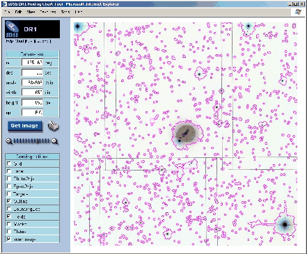
The SkyServer Web site provides interactive access to images and associated catalog data via Visual Tools, which include the Finding Chart, Navigator, Image List, and Explorer. These interlinked tools exchange information about the current selected object, allowing transparent mobility between data views. All of these visual interfaces use a common underlying SOAP Web service, ImgCutout.
To allow rapid data visualization, images are stored in JPEG format.
During the preprocessing stage, FITS images in 3 of the original 5 bands
are combined to create a color JPEG image. The JPEGs are stored in the
database at 5 zoom levels, along with associated astrometry information.
This preprocessing facilitates rapid recovery of the frames and
geometric transformations needed to create dynamically a mosaic of any
region of interest. Mosaics can be as big as 2048 ![]() 2048 pixels,
covering approximately 34
2048 pixels,
covering approximately 34 ![]() 34 degrees.
34 degrees.
Many interesting features can be overplotted on top of the images. The Field option displays the boundaries of the original FITS images used to construct the mosaic. The Plates checkbox shows the boundaries of the aperture plates used to obtain spectra chosen from a list of potential Targets. Selecting SpecObjs or PhotoObjs highlights objects in the image with spectroscopic or photometric data. Outline and BoundingBox options mark the pixels associated with each object (Figure 1).
Due to bad weather, bright stars, satellite trails, or other anomalies, 10-15% of the raw survey data are substandard. The SkyServer Mask option allows easy identification of regions with poor data quality. This visualization tool helps guide data analysis and lets users decide quickly whether particular data are useful for their purposes.
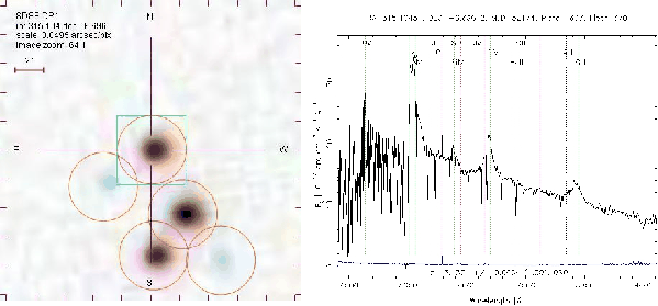
Using the Image List tool, users can simultaneously view thumbnails of SDSS images for objects specified by a list of coordinates. The thumbnails provide a visual index for objects specified by the user or returned by an SQL query of the database. More detailed data views can be interactively selected from the Image List tool allowing creation of Finding Charts, for example.
The most interesting feature of this tool is that users can generate a list of coordinates and associated thumbnails by querying the database directly using SQL. For example, visual inspection of the thumbnails generated in response to the following search for high-redshift quasars:
The user interfaces described above are all layered on the ImgCutout Web service for SDSS data in the SkyServer database, but the same principles would work equally well for other surveys. Interactive tools must respond quickly to be successful, so JPEG images and database indexing should be considered for any generic image cutout service. In general terms, the system is constructed as follows:
The database provides images and object data to an image cutout service in response to SQL queries. The cutout service assembles the images into mosaics and displays the mosaics with the selected overlays. In the specific case of the SDSS, we perform these tasks using the following technologies:
Fekete, G., Szalay, A., & Gray, J. 2004, this volume, 289
O'Mullane, W., Gray, J., Li, N., Budavari, T., Nieto-Santisteban, M., & Szalay, A. 2004, this volume, 372
Thakar, A., Szalay, A., & Gray, J. 2004, this volume, 38